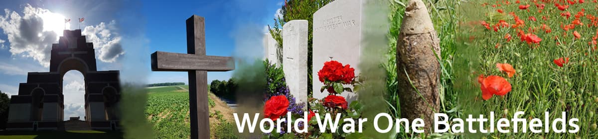
This page covers the preserved trenches at Bayernwald, which is near the village of Kemmel, and also covers other Great War sites located in and near Kemmel village.
Bayernwald Trenches
There are several sites where preserved trenches from the Great War can still be seen today. In the region around Ypres, there are British trenches to be seen at Sanctuary Wood, and also at the Yorkshire Trench site north of Ypres. More trenches can be sen at Vimy Ridge, and on the Somme at the Newfoundland Memorial Park.
The trenches to be seen at Bayernwald, in contrast, are German trenches, and the site is well worth a visit. A ticket is needed to enter the site, which is quite remote and is unmanned – tickets should be purchased in advance from the tourist information office in Kemmel. This is a new building, and there are also toilets downstairs. The map below shows the location of the tourist office where you buy your tickets, and the trenches themselves.
Once you have your ticket, it is about a 10-minute drive to the trenches, which are located north-east of Kemmel village. There is some parking available at the site, and your ticket should be inserted into a slot on the gate, where it is scanned. Wait for the green light to show the scan is complete, then push the left side of gate forwards.


There is a sheltered information area on the left as you enter the site, which has information boards about the trenches including wartime aerial photographs as well as a modern aerial view of the site. There is also a bronze relief map of the salient. By the side of the shelter is a large stone which was put in place in 2014, 100 years after the start of the war. In several languages, the inscription reads: “It is time not to look back in anger but to look forward with hope”.


Also here are wartime photographs of German soldiers manning these trenches. There is a schematic showing the layout of the trench system, which includes four bunkers and two mineshafts. Another information board explains that one of the mine shafts was unearthed in 1971 by schoolteacher Andre Becquart. He later excavated the four bunkers and opened the site as a museum.
However, after he died the site was more or less abandoned, until in 1998 restoration work commenced. This was initially made possible by Heuvelland council, and later also by the Association for Battlefield Archaeology in Flanders. The restored trench system was opened in 2004. The trenches had started to fall into a poor state of repair a few years ago, but more work has been done and happily they are now in much better condition.


There are a number of information boards at various points around the site, and one of these explains that the earliest trenches were built with wood and sandbags, whilst later (1916) trenches were constructed with reversed A-frames connected by wickerwork. There are wartime photos of trenches which can be compared with the restored trenches.
The trench system contains two mineshafts, one (Berta 4) 17 metres deep. This was the shaft discovered by Andre Becquart in 1971. An information board nearby shows the layout of the shaft, as well as photographs from its excavation.

Mine shaft at Bayernwald trenches
There are four bunkers within the trench system, made of prefabricated concrete blocks. An information board explains that those near the front line were constructed of the prefabricated blocks, which makes sense as the positions would have been subject to enemy fire. Further back, concrete without the need for prefabrication could be used.
Whilst four bunkers can be seen today, in 1918 there were 10 bunkers at Bayernwald. An information board shows details of how they were constructed, plus a photograph of one partly built.


Bayernwald is well worth a visit – not only because of the trenches themselves, but also the thought that has gone into the information boards that give background to the bunker construction and the mineshafts, as well as the information on display, including contemporary pictures of trenches and other items.
Nowhere near as busy and popular as the trenches at Sanctuary Wood, perhaps because of it’s remote location, the Bayernwald trench system deserves a higher place on the list of “must visit” sites in the Salient.
In the fields opposite the turn into the trench site, opposite the parking area, a cemetery can be seen. This is Croonaert Chapel Cemetery, reached by a track leading off to the left a little further up the road past the turn to the trench site. At the start of the track is a meorial to a French soldier, Lieutenant Lasnier, who died in 1914, and a cross commemorating Private Bourges. The cemetery itself was started in June 1917, and the name comes from a shrine which stood in No Man’s Land before the Battle of Messines.


It is a small but beautiful cemetery, with just 75 graves. There was also some 50 German graves sited here originally, but these were remnoved after the Armistice. Many of the burials are of men killed in June 1917 at the time of the Battle of Messines, and there is also a grave of a man from the Chinese Laboutr Corps, who died n 1919.
Kemmel

A view of Kemmel Hill shortly after the War. Photo: NELS
Kemmel village is around six miles south-west of Ypres and is reached by following the N336 out through the Lille Gate, and then turning right onto the N331 about half a mile further on (just before the level crossing). Kemmel Hill is a tourist area, popular with cyclists and walkers, and the views from the hill over the surrounding countryside are superb.
Located just to the north of the village centre is Kemmel Chateau Military Cemetery. The entrance is flanked by twin brick-built arches, and the village cemetery is located immediately to its left.
Many of the headstones are quite irregularly spaced. The cemetery was established early in the war, in December 1914, taking its name from Kemmel Chateau which stood to the rear of the cemetery. At times, the chateau housed an Advanced Dressing Station (ADS), and the cemetery continued to be used until March 1918, when Kemmel was taken by the Germans. Although it was retaken later on that year, both the cemetery and the chateau suffered from shelling with the chateau being destroyed.
In total there are 1,135 First World War soldiers buried here, all but three being identified. In addition, located in a row on the left by the entrance are 21 Second World War burials.


In Row X is one of many Canadians buried here: Private Henry Harry Jackson (originally from Cumberland in England). He enlisted in September 1915, and probably died as a result of wounds he suffered when his battalion, the 72nd (British Columbia Regiment), carried out a raid near Kemmel on the 16th of September 1916.
The battalion war diary reports that it was a bright moonlit night and that although all the raiding party returned to the trenches, five of them were wounded. They did, however, take two German prisoners – capturing enemy soldiers to determine which units were in the line was often an objective of raids.
Also buried here is an uncle of the novelist Daphne du Maurier – Lieutenant Colonel Guy du Maurier, who was a veteran of Burma and South Africa. He was commanding the 3rd Royal Fusiliers and was aged 49 when he died in March 1915.
There is a small square in the centre of Kemmel village, with shops and restaurants lining it. From here, a road leads out of the village and up the hill. After a few hundred yards there is a parking area and information boards on the left-hand side.
Just opposite this, a cobbled track leads uphill off to the right, past the restaurant De Alverman. This road leads up Kemmel Hill (Kemmelberg). The road winds uphill steeply, past the tower of the Belvedere restaurant on the left. The tower can be climbed for an entrance fee and has excellent views of the surrounding country. This tower is a replacement for one sited here before the war, which was used as an observation post during it.

The Belvedere on Mont Kemmel
Carrying on up the hill, at the top is another parking area, by which is a large French Memorial. This is a tall, imposing white monument, with the figure of an angel on the front. It was unveiled on a misty day in September 1932, by Marshal Petain, who also referred in his speech to the British 9th Division which was also involved in the action.
The figure represents France, the granite monument behind is 54 feet high and topped by a poilu’s helmet. On the front are the words ‘Aux soldats Francais 1914-1918’. The angel has her eyes closed, with what seems an expression of suffering and sadness on her face.


The memorial is to commemorate French soldiers who fought and died here in April 1918. The British held Kemmel Hill against a determined German onslaught on the 17th of April 1918, and it was just after this that the French took over the lines here. The Germans attacked again, using gas, on the 25th of April, and this time broke through taking the hill. However, their final offensive was now running out of steam. On a road a little to the west of Kemmel Hill is one of the demarcation stones that mark the limit of their advance.
The cobbled road continues from the summit down the other side of the hill, and at this point is extremely steep indeed, and the cobbles can be slippery. Down this road, visible from the monument at the top of the hill, is the French Cemetery and Ossuary.
There are information boards outside the Ossuary to the left, and these show interesting photographs of the site over time. The earliest show the excellent views behind the Ossuary, which in later photographs and today are blocked by trees.


The Ossuary was constructed after the war and contains the remains of many of the French soldiers who fell trying to defend the hill in April 1918. For those used to the individual headstones of Commonwealth War Graves Commission cemeteries, it is somewhat shocking to learn that 5,294 soldiers are buried in this small area, with only 57 of these identified. The 57 identified are listed alphabetically by name on the front of the obelisk in the centre of the Cemetery. On the other side is a plaque which gives the total number.
This approach of mass burials contrasts with that of the CWGC. It was determined very early on that the names of each and every British and Commonwealth soldier who died would be commemorated individually, on headstones above their individual graves, or on ‘special memorial’ headstones when it was thought they were buried in a certain cemetery, or it was known they were but the location of the grave had been lost.
For those who had no known grave, their names would be inscribed on a series of Memorials to the Missing, such as at the Menin Gate in Ypres and at Ploegsteert to the south. Anyone visiting CWGC cemeteries will have seen the many unknown burials, again each with an individual headstone with the inscription “Known Unto God”.
Just south-east of Kemmel Hill is Lindenhoek Chalet Military Cemetery, located a little way off the N331. Tiers lead up along the side into the cemetery, which was started in March 1915 and used until October 1917. After the Armistice, more than a hundred additional graves were concentrated here from the battlefields in this area. In total, there are now 315 men buried or commemorated here, and of these 67 are unidentified. To the left of the Cross of Sacrifice are special memorials to four men known, and two believed to be buried here. Some of the headstones in the back row appear quite discoloured from lichen.


The names of six men from the 1/4th East Yorkshires, all of whom died on the 17th of June 1916, are inscribed on three headstones in row K of Plot One. Nearby, another five men from the same battalion who also died on the same day are commemorated on a further two headstones. At least some of these men were from ‘A’ Company, as recorded in the register.
This territorial battalion, in fact, lost 18 men and one officer killed in action on the 17th of June 1916, and a further nine died of wounds the same day. In fact, all those who were killed in action that day, except one, are buried here at Lindenhoek Chalet Cemetery.
The War Diary for the 1/4th Easy Yorkshires showed that at 12.25 a.m. there was a German gas attack on their trenches near Wytschaete. The gas cloud was reported as “very thick” and it lasted for about 20 minutes. The single officer who died was Second Lieutenant William Carlton, who died in F Trench. At that time there was a dressing station at Lindenhoek, where several of those affected by gas died.
On June the 18th 1916, the War Diary records that Second Lieutenant Carlton and 17 other ranks were buried at this cemetery. The cause of death was detailed as six from shell-fire and eleven from the gas.
The American monument is north-east of Kemmel, on the N331. It is a large white Rocheret stone set within short white pillars. An information board is located on the left-hand side, giving the historical background. The monument commemorates the actions of US soldiers from the 27th and 30th Divisions who fought in August and September 1918.
Around 1,300 from the 27th Division and 800 from the 30th Division died in these actions, which followed a German withdrawal. The monument stands in the middle of the area over which the US troops made their advance, and was erected in 1929. Some of the Americans who died during these actions are now buried in the Flanders Field American Cemetery, which is near Waregem, about 35 miles east of here.


Just to the right of the American monument is a Demarcation Stone. These were erected after the war to mark the furthest points to which the Germans advanced, and originally there were many, although only a small number now remain. This one was moved from its original location here (or nearby) after the Second World War to Vierstraat. It was moved back to the Kemmel road in 2005.
Sites North of Kemmel
Returning to the main N331 the same way you came, one can, instead of turning left at the crossroads back towards Kemmel, go straight across, following a minor road. The small settlement at these crossroads is known as Vierstraat At the first left turn leading off this road is another Demarcation Stone, similar to that seen near the American Monument (above).

Demarcation stone near Suffolk Cemetery
Just a little way down the road leading off by the demarcation stone is Suffolk Cemetery. A short path leads up to it, and there are just three rows of graves, with 47 men buried here. Only eight of these are unknown.
The cemetery was started in March 1915 by the 2nd Suffolks, and used by them for just that month and April 1915. The front two rows contain these burials, and the headstones are quite close together. In November 1917 one man was buried here, and after that, the cemetery was not used again until October 1918, when the bodies of men killed during the German advance six months earlier were buried here by the 38th Labour Group.


The bodies were mainly those of men from the 1/4th and 1/5th York & Lancaster Regiment. The cemetery at that time was known as Cheapside Cemetery, as the small road it is located beside was known by that name. In early 1918 there were a number of camps nearby, with structures around the location of the cemetery; the position known as Fort Toronto.
Returning from Suffolk Cemetery to the demarcation stone, turning left again on this roads leads to two more cemeteries. First reached, on the left side of the road, is the interesting Kemmel No. 1 French Cemetery.
Despite this name, this is a CWGC maintained cemetery. The CWGC entry for this cemetery states that “the origin of the cemetery is not known”. It was found by the French Graves Service shortly after the Armistice, and at that time contained Commonwealth, French and German graves.
Some more German graves found by the Belgian Graves Service were then brought here, as were more Commonwealth graves from both nearby and further away. Later on, all the French graves were removed, some to the nearby Ossuary at Kemmel (see earlier on this page), and some to the French cemetery at Potijze.


There are now 94 Germans buried here, and of the two rows of headstones marking Germans graves at the back of the cemetery, the first row is actually a mass grave. There are also a few German graves among the other rows. There are 296 Commonwealth graves, and of these only 41 are identified. This probably reflects the lack of records of this cemetery originally and also the later recovery of bodies from other sites which were then brought here. Still, it is a tiny number of identified graves, and in percentage terms must be one of the highest of unidentified soldiers for any CWGC cemetery.
Those who are identified died in all years of the Great War, although the majority of the graves are from the later years. Railway sleepers run along the cemetery boundaries in places. From the back of the cemetery, Kemmel Hill is visible.
Just across the road is Klein-Vierstraat British Cemetery. It was started in January 1917, and the first three plots date from that year until the middle of January 1918. Plot 4 was begun in April 1918, and after the Armistice, more graves were concentrated here from two smaller cemeteries at Poperinghe and Westoutre, and from battlefields nearby.
There are now a total of 804 Great War burials, 109 of them being unidentified. At the front right of the cemetery is a square structure which houses the register box, and the rows of graves are set on a slope downwards from the front of the cemetery.


Locre
Locre (today Loker) is a small village located about two miles or so to the west of Kemmel. Next to the road leading there (Lokerstraat) are some British bunkers, known as the Lettenberg bunkers. These are located to the right side of the road just as you come out of Kemmel, climbing up a hill towards Locre, at the edge of some woodland. They are reached by a short path through the woods, which is signposted – take the left fork of the track as it enters the wood.


The bunkers were constructed in the spring of 1917, although the 175th Tunnelling Company had been digging to create underground headquarters here for some months before that. There are four bunkers, including a first-aid post which has a red cross painted on the wall, and a command post located at the far end. There are information boards outside the bunkers.
Locre Hospice Cemetery is to the south-east of Locre village, reached by following a small road called Godtschalkstraat. The cemetery is on the upslope of a hill, to the right of the road as you leave Locre. A grass track leads to it from the road. It is a long narrow cemetery, containing just three long rows of graves. The cemetery was started in June 1917 and used until April 1918.
The Hospice itself from which the cemetery takes its name was originally nearby. In April 1918 Locre was captured by the Germans, fought over and then retaken by the French on the 30th of April 1918.


There are just under 250 Great War burials or commemorations here, and at the far end of Row 3 are 14 Second World War burials. These graves date from late May 1940 and the withdrawal of the British Expeditionary Force to Dunkirk ahead of the German advance.
Behind the Cross of Sacrifice are nine special memorials commemorating men known to be buried in the cemetery. A path runs by the right-hand wall of the cemetery to a site at the rear of the cemetery where Major William Redmond’s grave is located.
Despite being buried outside the walls of the cemetery Major Redmond is listed in the Locre Hospice Cemetery register. Rather than the usual Plot, row and grave number, his grave position is described as “close to the path leading to the cemetery”. Major Redmond was mentioned in Despatches and was also awarded the Legion of Honour by the French. He had served as MP for Wexford since 1884 and was 56 when he died of wounds received at the Battle of Messines.


Major Redmond, along with three other men, was originally buried in the garden of Locre Hospice. Standing either side of the cross are two stones which originally were part of the Hospice buildings. Behind the cross is a modern pipe, on top of which is a figure of the Virgin Mary.
On the road leading into Locre is the rebuilt Hospice. In front of it is a small part of a stone wall from the original. The information board tells the story of Major William Redmond,


Sources & Acknowledgements
Beatrix Brice: The Battle Book of Ypres
The Great War Forum
Major & Mrs Holt: Battlefield Guide to the Ypres Salient
Michael Scott: The Ypres Salient
Paul Reed: Walking the Salient
Rik Scherpenberg for information on the Demarcation Stone
The Times online archive
You must be logged in to post a comment.