Guidebooks to the Battlefields
|
Major and Mrs.Holt's Battlefield Guide to Ypres Salient (Amazon) |
This guide is an excellent volume for those visiting the Salient for the first time, or for those who have very little time and want to cover a lot in one day or a couple of days. The book covers the history of the region, a summary of the battles fought and includes a large scale map in which all the sites and places described are marked. There is a section on approaches to the region for the drive from the Channel ports, either quick and direct or options of routes which have sites of interest along the way. There are then three itineraries, which are very detailed with driving instructions, map references and even timings and mileage to make following them really very easy. There is also some tourist information, which is helpful for the first time visitor, and overall if you have never visited the salient before, have little time and want to see as much as possible I don't think you can beat this guidebook. |
|
Major and Mrs Holt's Battlefield Guide to the Somme (Amazon) |
This guide follows the same format as the guide to the Ypres Salient (above). All the comments on that volume therefore apply here - an excellent choice for those with little time who want to cover a lot in one day or a couple of days. Again, background, routes to and suggested itineraries for the motorist touring the Somme battlefields are provided. |
|
I have found this an invaluable companion to some of my visits to the Somme region, as I enjoy walking as well as looking around the battlefields. As stated elsewhere, my preference when visiting the battlefields is to get off the roads, and traveling the quiet tracks of the Somme is highly enjoyable in its own right. In this book Paul Reed has devised 15 walks, all of which are circular, so you can leave your car at the start point and the walk returns to it's location. The walks all have a theme, and Reed has included lots of information and background, including excerpts from soldiers diaries and letters plus historical photos of the battlefields including aerial photographs. There are also fascinating early pictures of some of the Cemeteries, plus copies of trench maps. The walks are of various lengths, and it is possible with a little ingenuity to combine two or more to make slightly longer walks if you enjoy longer distances. However, the walks are not intended as route marches, so allow sufficient time to stop and see the sites and experience the pleasures of walking the Somme. The book has also been updated fairly recently to a second edition. Very highly recommended. Paul Reed also has his own website with much more valuable information. |
|
|
A similar book to Paul Reed's Walking the Somme (see above). Twelve walks are described, again each starting and returning to the same point, making it easy to leave your car for the day and explore the Salient on foot. I have enjoyed some of the walks in this book. The only downside is that the Salient is less conducive to hiking off the beaten track than the Somme, simply because it is more developed and has changed much more since the War. Again, however, the mix of historical photographs, trench maps and comprehensive information on what you see around you make this a valuable guide if you can take the time to explore the battlefields more fully. |
|
|
This is the third and most recent of Paul Reed's three books on walking the battlefields. Published in 2007 by Pen & Sword, it has a slightly different feel to the previous two (see above). In this case, Paul has written ten chapters covering the Arras battlefield, in each case split into three sections - a detailed and throughly researched analysis of the action in that area, followed by a short section covering a battlefield walk for that area. There then follows a listing at the end of each chapter of some of the cemeteries in the area coverd by that chapter, giving their backgound and detailing burials of particular interest and relevance. This change means that the book acts more as a analysis and historical work on Arras, but with the added bonus of walks relevant to the area. It is notieceable that there are many more references quoted at the end of each chapter than in the previous two books. The first chapter deals with Vimy Ridge, perhaps the best known Arras site and certainly the most visited. However, there are a further nine chapters and these cover in detail the battlefronts of the VI, VII and XVII Corps involved in the battles, with the last four chapters covering specific areas such as Monchy-le-Preux and Bullecourt. As in the eariler books, the text is coupled with numerous period photographs and maps, as well as more modern views of the area today. There are also useful sketch maps of the walks themselves. In his introduction Paul Reed states "Walking remains the best way to see any battlefield"; and he is right. Taking a walk around any Great War area allows you to appreciate the land, the contours, the features and their relavnce to each other in a way that you cannot do when driving, even if making frequent stops. Of course, the appreciation itself requires a good understanding of the area and the action. Both Walking the Somme and Walking the Salient have been invaluable aids to me in seeing the areas they cover, and I think the new more in-depth approach taken in Walking Arras will make this an even more invaluable guide. |
|
|
Not the earliest guidebook to the Western Front battlefields (they were coming out in the 1920's!), but perhaps one of the earliest that helped spark the resurgence of interest in the First World War. Originally published in 1976, it is interesting to look at some of the photos that show the battlefields as they looked back then. All the photos are black and white, but the book covers pretty much the entire Western Front, with sections from Zeebrugge to Verdun and beyond. There is historical context, maps and the book is put together by someone with an obvious deep interest in this subject. It has been updated several times and is now published by After the Battle. |
|
|
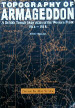
Peter Chasseaud Topography of Armageddon
|
Whilst this is not strictly a guidebook, like many others I find trench maps absolutely fascinating . Walking the battlefields is a pleasure that for me can only be enhanced by comparing the ground and the features to a trench map of the area (sometimes several, as they cover the progress of a battle) dating from the First World War. Original trench maps are now expensive to buy, but there are several sources of copies if you have an interest. One of these is this book, which is around A3 sized and contains nearly 200 maps covering the Western Front. They are generally of excellent quality, although a few could be a little clearer. However, there are several covering Flanders, the Somme and others all along the Western Front. They vary from those showing the British trenches only to those (classified at the time Secret) versions showing all trenches, plus enemy machine gun posts etc. There are some smaller scale maps showing whole battle areas, including artillery firing instructions, and even some hand drawn large scale maps of certain areas. The book contains a comprehensive introduction detailing how trench maps were made, and how the early versions developed from copies of 1:80,000 French maps to specific and rapidly changing maps of sectors of the lines. Many of the maps included are at the 1:10,000 scale which is perhaps the best to trace outlines of trenches and other features when you are walking the battlefields. If you are interested in maps and trench maps, this is a great book to allow you to explore the battlefields in greater detail, and the maps can be wonderful in allowing you to relate what happened to the current landscape. For information, two other sources of trench maps are the Western Front Association and the Naval & Military Press. |
|
This is an extremely comprehensive guidebook covering the Somme battlefields in great depth. It spans not only the well known 1916 Somme offensive, but also those areas further south and east, which were prominent later, in the spring of 1918, when the Kaiser's Offensive, Germany's last throw of the dice to try and win the War, pushed the allies back. There is also information on the Second World War. The book is split into sections, which cover each particular area (for example The Peronne Road, which deals with Fricourt, Mametz, Carnoy, Montauban and Maricourt) in great depth. There are hand drawn maps, and it is possible to devise your own walks from these to cover some of the sights within an area. There is information on all the Cemeteries, plus other features of interest in that area. Overall, this book is fascinating in terms of reading for invaluable information, for any visit to the Cemeteries or other features during a short visit, and as a companion book during a more extended tour of the battlefields for those who have the time. For those with more than a passing interest, a must have. No longer seems to be in print, but still available second-hand or via Kindle. |
|
|
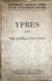
Michelin Ypres and the Battles for Ypres
|
This Illustrated Michelin Guide to the Battlefields (1914-1918) is one of, if not the earliest, guides to the Battlefields. It was published by Michelin in 1920 and includes illustrative photographs that show the damage to the localities only a matter of months after the war had ended. The book is now back in print courtesy of the Naval & Military Press, and as it is out of copyright they have not objected to my using several photos from the book on this website. The photos themselves, as well as the captions with them are fascinating; the Guide gives directions for touring the battlefields by car in a two day touring itinerary, and in several places is the statement "road impassable by motor" - simply because when the guide was put together it was impossible to traverse some of the more badly damaged roads. However, this is more than just an itinerary. The first part of the book is devoted to an chronological account of the battles of Ypres, giving the historical perspective (just after the War had ended) on the campaigns. Towards the end is information on the British forces and their Commanders who were engaged in the fighting in this region. I haven't seen the modern reprint, and therefore do not know if any additional information is presented in it. |
|
Major & Mrs. Holt's Concise Illustrated Battlefield Guide - The Western Front - North (Amazon) |
The Holt's guidebooks to the Ypres Saleint and the Somme have been providing very useful itineraries to these battlefields for visitors to the Western Front for many years. More recently, two additional volumes have been published: covering the northern area of the Western Front (this volume) and the southern area (see below). The format is basically the same as the earlier volumes: a historical summary of the battle and what happened, then a tour of the main sites there are to see on the battlefield today. Each section is accompanied by a map showing the locations of the sites of interest, imarked in the colours already familiar to readers of the other books (i.e. purple for cemeteries, yellow for memorials etc.) This volume covers the following areas: Mons; Le Cateau; The Yser; the four battles of Ypres; Neuve Chapelle; Aubers Ridge; Festubert; Loos; Fromelles and Vimy Ridge. Obviously, the sections on the various Ypres battles are relatively small compared to the main volume on the Ypres salient, and cover sites dealt with in the main guide to these areas. But there is a wealth of useful information on the other, less visited areas - Neuve Chapelle for instance, where the British fought their first set-piece offensive of the war, and Loos, where there is much to see that perhaps is not as 'high profile' as other areas. Even though I already owned the Ypres Salient and Somme volumes (the Somme is covered in the Western Front South volume), these volumes are a valuable addition to the battlefield tourist who is interested in exploring the Western Front beyond the main sites of the Somme and Flanders. There are relatively few books and guidebooks on some of the less visited battlefields, and I have used these guides extensivly on my travels. |
|
Major and Mrs. Holt's Concise Guide to the Western Front - South (Amazon) |
As above, this is a guide to quite a number of areas found a little further south on the Western Front. The same comments as above apply. This volume covers the following areas:- First and Second battles of the Marne; St. Mihiel Salient; The Aisne; Verdun; The Somme; Chemin des Dames; Cambrai; Kaisers Offensive; Champagne; Meuse-Argonne and the Hindenburg Line. |