Fricourt
Fricourt is around three miles due east of Albert, and was towards the southern part of front on which the British attacked on the 1st of July 1916. In this area there was early success, with nearby Mametz captured on the first day and Fricourt taken on the 2nd of July. It was the 21st Division which attacked at Fricourt on the 1st of July, and the 10th West Yorkshires of 50th Brigade were heavily involved and indeed suffered very heavily (see Fricourt New Military Cemetery below).
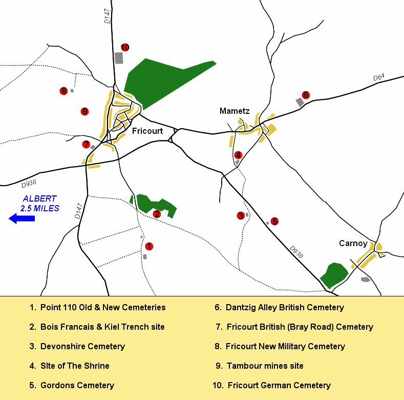
Map of Fricourt and Mametz area
On the 2nd of July, the 7th Division held Mametz and so were able to send patrols into Fricourt from the east, whilst the 8th South Staffordshires of the 17th Division advanced on the village from the south-west. The village was captured, with around 100 prisoners being taken. There is a great deal of interest to see in and around the village today.
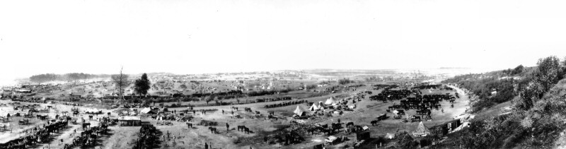
Camps and horses in Fricourt valley. Q930: Photograph courtesy of the Imperial War Museum, London.
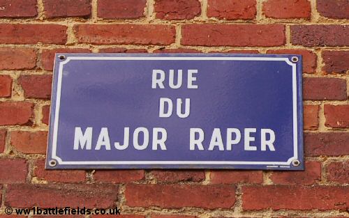
Starting in the centre of the village, there is an information plaque next to an area where the villagers play boules. There are also parking spaces here, and it is a convienient place to leave you car and explore the area on foot. Several of the street names in the village have connotations with the Great War; there is the Rue Marechal Foch, the Rue de Ipswich (Fricourt and Bazentin were 'adopted' by Ipswich after the War), and on the wall opposite the left side of the church is a sign showing the streetname 'Rue du Major Raper'. This last is explained more fully below.
Before the War, Fricourt Chateau was located to the north of the village, between the village and Fricourt Wood. It was ruined during the war, and a stage in this destruction is shown in the picture below.
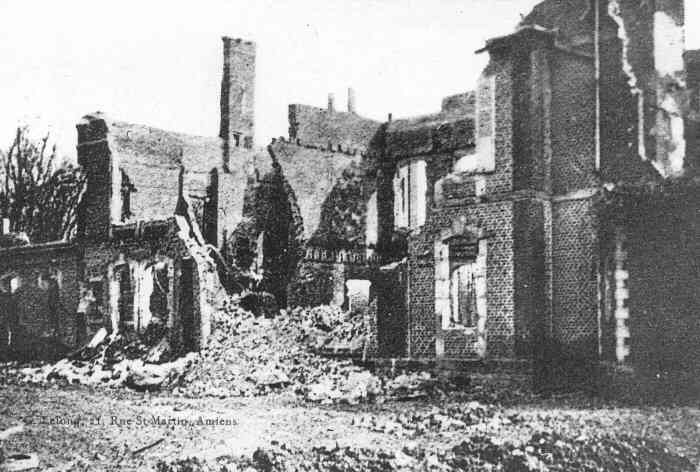
The ruins of Fricourt Chateau Photo: Vise Paris
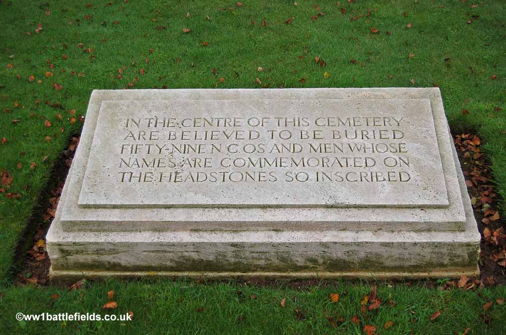
Also in the village is Fricourt British Cememtery, sometimes also known as 'Bray Road Cemetery'. Fifty-nine soldiers are believed to have been buried in a shell-hole in the centre of the Cemetery. This information is given on a large stone tablet inset in the turf of the cemetery. As their graves were not individually marked, special memorials on either side of the cemetery entrance and along the walls further within commemorate these men. Those on the left side of the cemetery entrance were nearly overshadowed by foliage recently.
Fricourt British Cemetery, and the tablet recording
that 59 soldiers are thought to be buried in the centre
One company ('A' Company) of the 7th Yorkshires (Green Howards) attacked fifteen minutes after zero hour at 7.45 a.m. on the 1st of July 1916 due to some confusion or misunderstanding with the orders, and were cut to pieces by a single machine-gun as a result. This cemetery still contains a stone memorial cross placed there in memory of those Green Howards who died near here that day. The original memorial placed here was a timber cross; many similar timber memorials were placed in cemeteries (for example there were two at Bapaume Post Cemetery near Albert) but to see one replaced by stone and still within a cemetery today is very rare, perhaps unique. A committee was set up after the war to consider the claims by various units for permanent battlefield memorials, and the comment by the Historical Section reviewing the Green Howards claim for this memorial was 'The testimony of the Brigade and Divisional Commanders is a sufficient reinforcement to the rather bald original claim'.
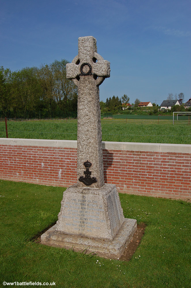
Green Howards Memorial in Fricourt British Cemetery
The cemetery contains just 133 burials, only one of which is unidentified. It was started early in July 1916 after the village was taken, and used until October of that year, with four more burials added in 1918. The location of the cemetery was in the No Mans Land of July the 1st 1916. Many of the names of those buried here can be seen also on the memorial cross to the Green Howards; for example that of Second Lieutenant Harold G. Hornsby. Hornsby, who was from London and before joining up had been on the Solicitor's staff of His Majesty's Customs and Excise, was one of the Green Howards killed on the 1st of July 1916, and a wreath on his grave when I visited showed he was still remembered by his family.
Also buried here is the Major Raper after whom the street in the village is named (see above). Major Robert Raper, before the war a solicitor, served with the 8th South Staffordshires, and was killed on the 2nd of July in Fricourt Wood. He was originally buried in a field acroos the road from the cemetery, as his parents bought the land on which his grave was located and this was maintained until the 1960s, when his body was moved here.
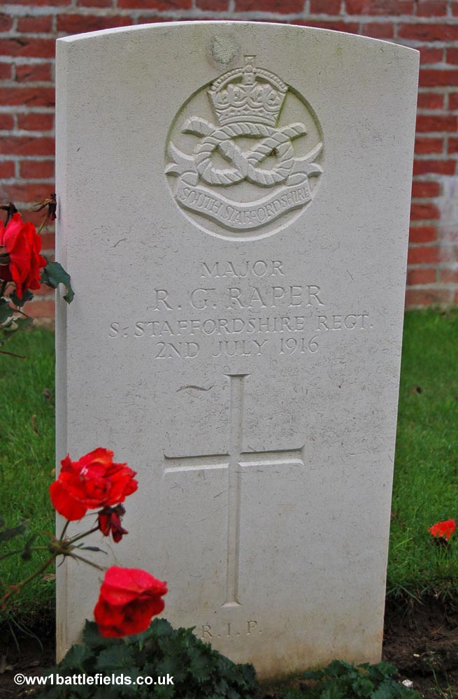
Major Raper's grave
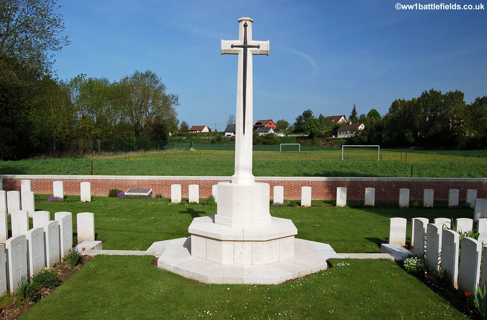
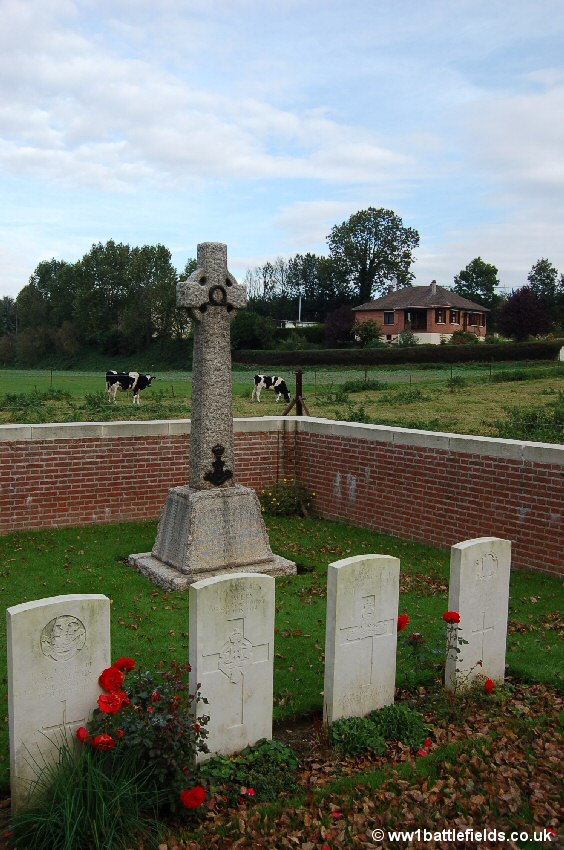
Another war cemetery, Fricourt New Military Cemetery, is located to the west of the village, reached by a track. The Bois Francais woodland dominating the high ground can be seen in the distance. This small cemetery has much to see of interest and it is well worth spending some time here. Row A and the Cross of Sacrifice are set on a slight bank, with the other five rows of graves slightly lower behind this.

Fricourt New Military Cemetery
Despite it's appearance, the cemetery in fact consists of four mass graves made shortly after the 1st of July attacks, with a few other graves added later in 1916. There are 210 soldiers buried here altogether, with most being identified soldiers, and the vast majority (159) are men from the 10th West Yorkshires; their horse emblem is seen on many of the headstones as you walk around the cemetery (see picture below).The 10th West Yorkshires attacked very near here (the cemetery is in what was then No Mans Land) by the Tambour mines (see below). The first two companies to attack made good progress, in part at least due to the firing of the mines. The third and fourth companies however, going over a little later were cut down by machine gun fire. It is believed that the casualties suffered by the 10th West Yorkshires were the highest for a single battalion on the first day of the Somme. They were higher even than those of the Newfoundland Regiment near Beaumont Hamel. The Commanding Officer (Lieutenant-Colonel Dickson), Second-in Command (Major Knott) and the Adjutant (Captain Shann) were all killed, with total casualties of 22 officers and possibly 750 other ranks, although a slightly lower figure of 710 total has also been suggested. Of these, just under 400 were killed, a very high ratio which reflects that those who were not killed outright as they advanced were pinned down in No Mans Land in clear view of the Germans for the rest of the day.
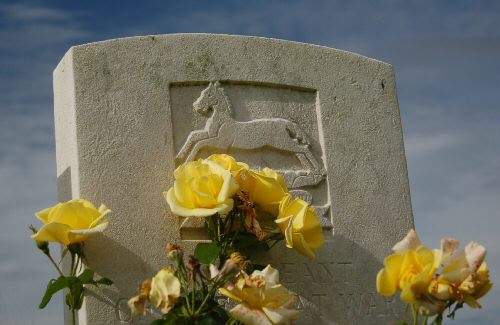
Emblem of the West Yorkshires on many headstones
All three of the senior officers named above were originally buried in this cemetery, and Dickson and Shann along with many others from their battalion lie here still. However, the body of Major James Knott is no longer here. His father, Sir James Knott was a man of influence who also donated the money to construct the tower at St. Georges Memorial Church in Ypres. At some point shortly after the war, James Knott's body was moved to lie beside that of his brother, Captain Henry Knott, at Ypres Reservoir Cemetery. Moving individual bodies in this way was extremely unusual, and went against all the principles established early on by the Imperial War Graves Commission. According to his file at The National Archives at Kew, James Knott was originally buried in row B grave 14, although there is no gap in the headstones visible today. As the letter dates from 1916, it is possible that the grave and row numbering used were different at that time.
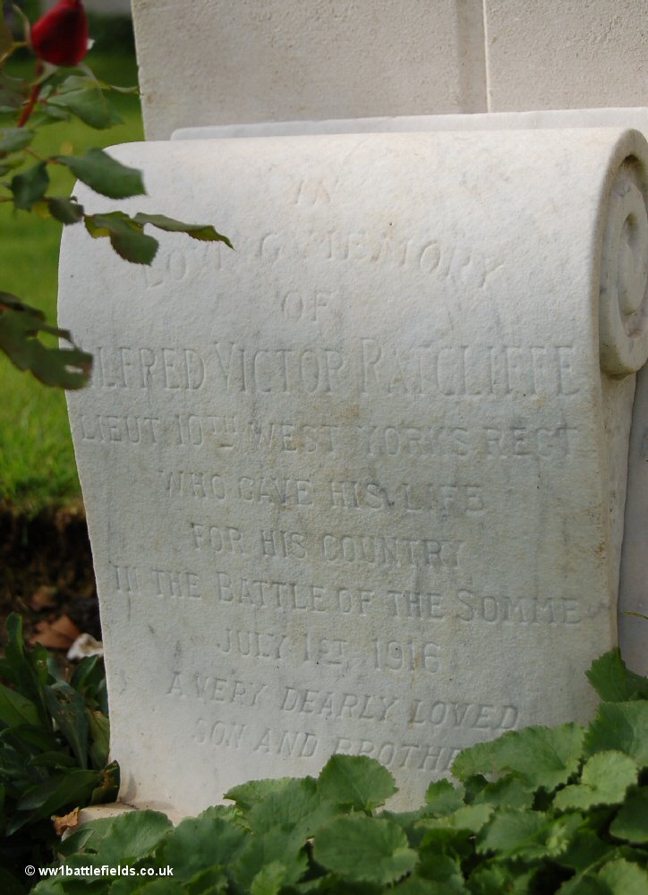
One of the 10th West Yorkshire officers buried here is Lieutenant Alfred Victor Radcliffe. Radcliffe was from Chelsea, and was 29 when he died on the 1st of July 1916. After the cemetery here was made permanent, his parents placed a private memorial by his headstone. This is in the form of a scroll made of stone, and actually obscures the inscription on the grave itself, which reads 'The world was sweeter for his life, and life lives poorer - by A Friend A.V.R.' The inscription on the memorial scroll can be seen in the photograph below right.
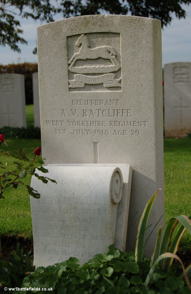
The grave of Lieutenant Alfred Radcliffe, andf the private memorial 'scroll'
placed there by his family after the war
Several of the graves here have two names on, and where those buried here are not identified by name, often their rank or regiment was known; so headstones may read 'A Sergeant...' 'A Lance Corporal...' or 'A Soldier of the Great War', although in many cases they are also known to be of the West Yorkshire Regiment. One headstone simply records 'Six Privates of the Great War. West Yorkshire Regiment.'

Single headstone for six unknown Privates of the West Yorkshire Regiment
One soldier buried here is one of the youngest casualties to die on the 1st of July 1916. This was Private Albert Barker of the 7th East Yorkshire Regiment, who was 16 when he died. In todays world, this seems almost beyond belief; he was just a boy.
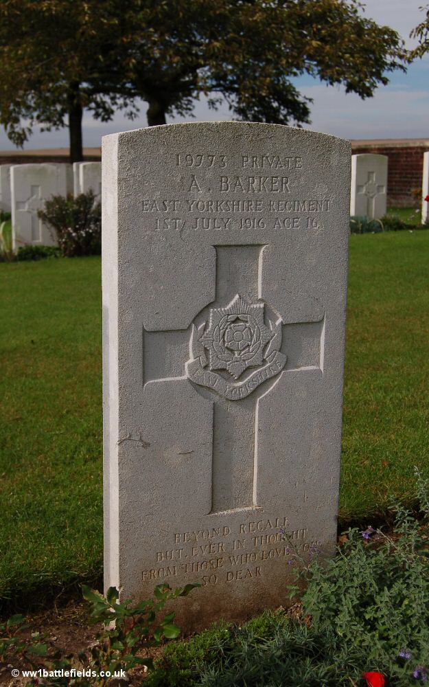
Grave of Private Albert Barker, aged 16
From the cemetery, a small area of cratered ground can be seen in the field beyond. These craters are from the Tambour mines, some relatively small mines which were detonated just before the infantry advanced on the 1st of July 1916. The land they are on is private property.
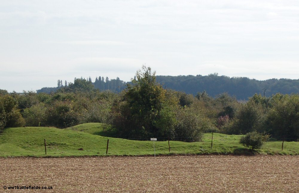
Site of the Tambour Mines
There was mining in the Tambour area well before the 1st of July 1916; the French carried out some mining operations here when they held this sector of the line, and British tunnellers were working here on mines as early as August 1915.
On the outskirts of the village to the north is Fricourt German Cemetery. It is located on the right hand side of the road which leads on towards Peake Wood Cemetery and Contalmaison. There is a register box just inside to the left of the gates, but on my last visit (October 2006) it was empty, awaiting replacement of the register.

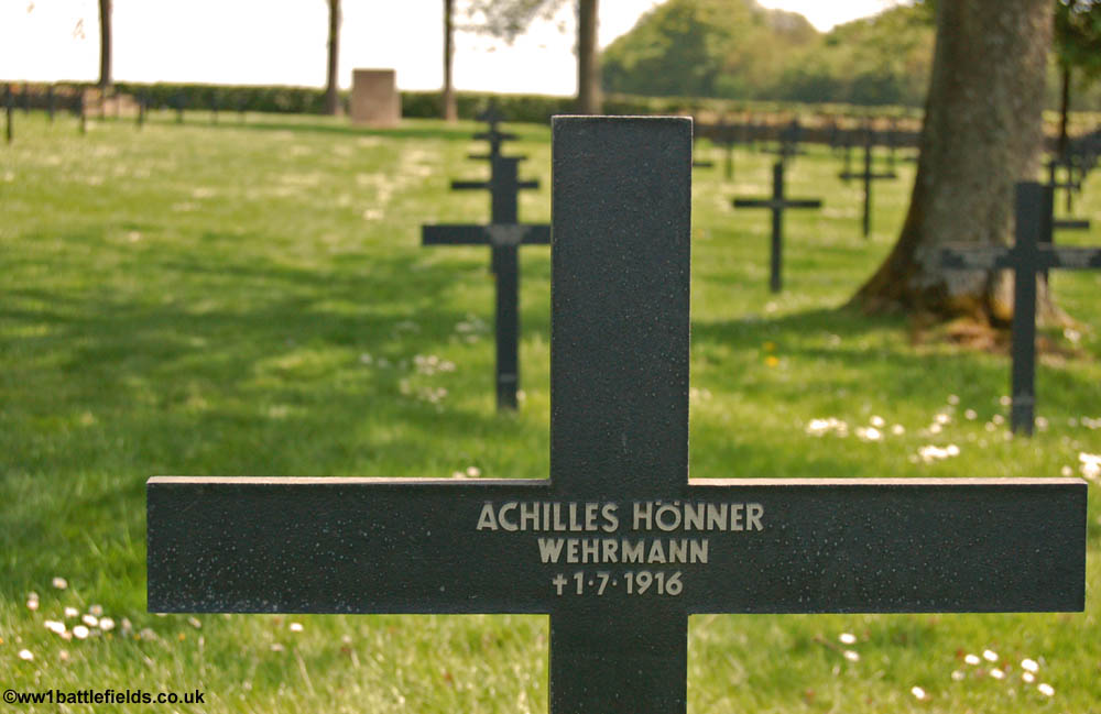
Fricourt German Cemetery
The burials are marked by black crosses, most with four names marked on them, two on either side. There are also stones set in the ground with more names on througout the cemetery. Among the crosses there are a few headstones marking the graves of Jewish soldiers. Most who visit find here find it a sombe, even a grim place, with somehow none of the appeal of many British cemeteries. Perhaps that is more fitting for a place of mass burial.
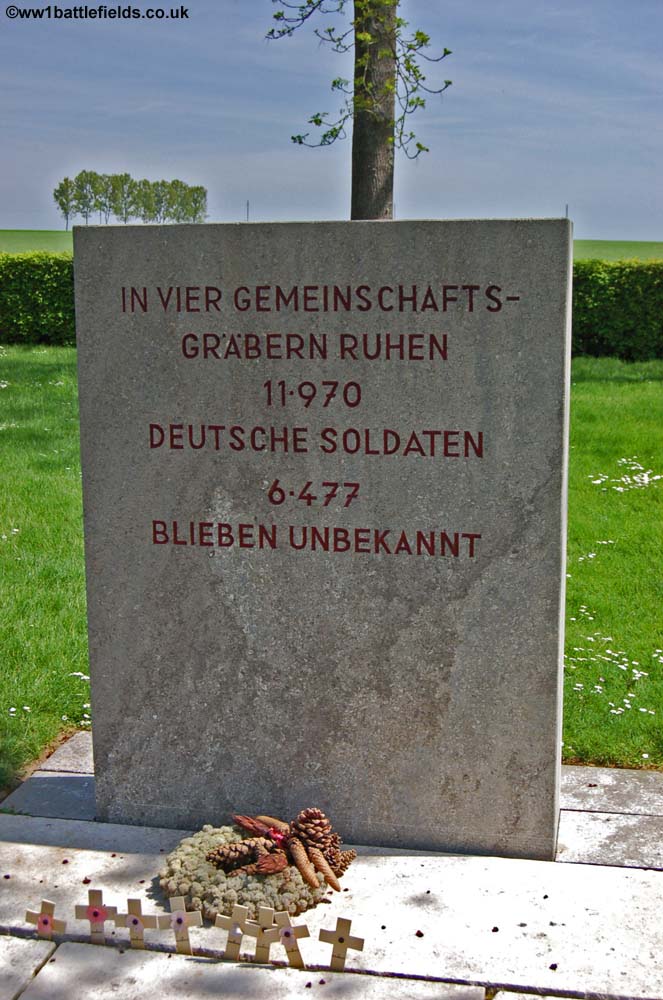
Space on French soil was at a premium for the defeated nation after the War and there are a large number of burials in this cemetery; just over 5,000 buried in the main plot and nearly 12,000 in mass graves. These are located at the rear of the cemetery, two large block built structures. Four sets of metal panels at the rear list the names, two either side of a central slab which shows the total number and also that 6,477 are unknown soldiers.
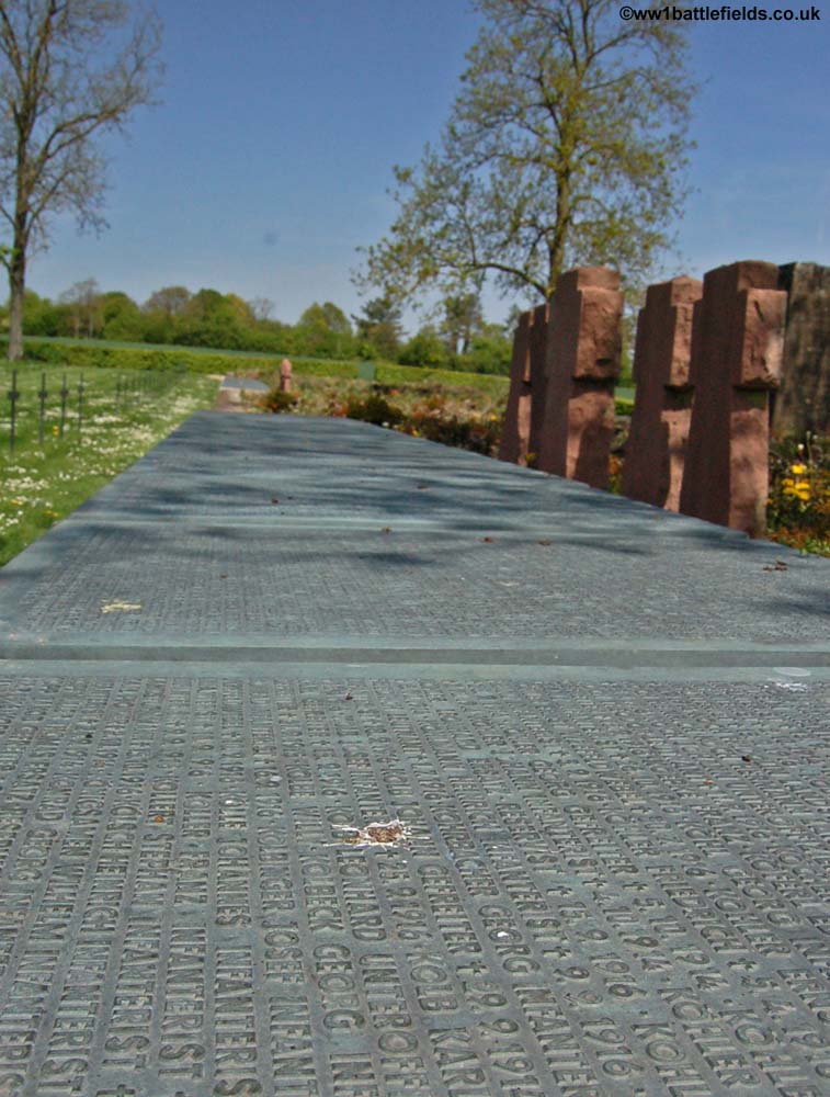
Fricourt German Cemetery - the panels listing the names, and number that lie here
Leaving Fricourt from the south on the D147 leads to a small hamlet, St. Quentin, and the road beyond this continues south.
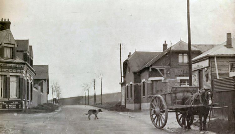
Cross-roads in Fricourt (St. Quentin) in the 1930s Photo: Keystone
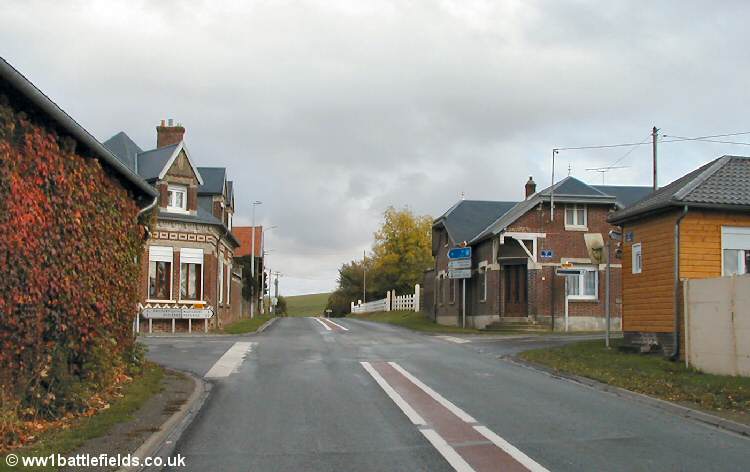
The same scene today
Up a small track a little further south I came across a Mills bomb embedded in the surface of the track. As with all munitions, this could still be deadly even after 90 years, so I took a photograph and left it where it had lain for many years.
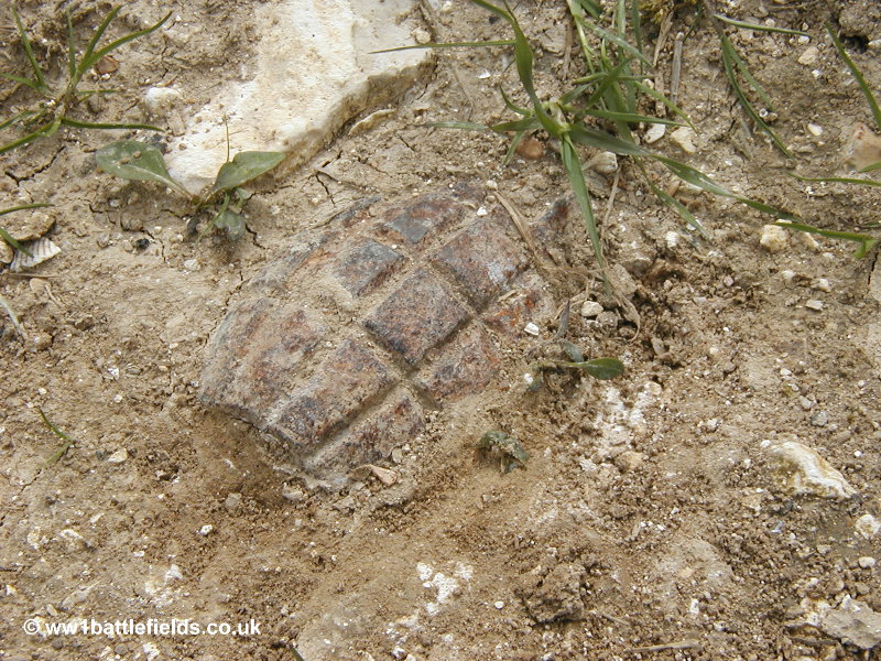
Mills bomb near point 71.S
The D147 continues from Fricourt towards Citadel Cemetery, and walking along it you are struck by how well it is protected by the bank to the left and the contours of the land. There were points near this road which were marked on trench maps as Point 71.N and 71.S, which are mentioned by Siegfreid Sassoon in his semi-fictionalised autobiography Memoirs of an Infantry Officer. The road leads to Citadel Cemetery and a track leading up the slope to the Bois Francais. These areas are covered in detail on the Mametz page.

Sources & Acknowledgements
Commonwealth War Graves Commission website
Brig-General Sir James Edmonds: Military Operations France & Belgium 1916 (Volume 1)
Gerald Gliddon: Somme 1916
Major & Mrs. Holt: Battlefield Guide to the Somme
Chris McCarthy: The Somme - the day by day account
Martin & Mary Middlebrook: Somme Battlefields
The National Archives: Various files
Paul Reed: Walking the Somme
Siegfreid Sassoon: Memoirs of an Infantry Officer
The Times & The Scotsman Archives
Ray Westlake: British Battalions on the Somme